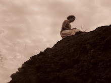
view on the way to Guayabo
This road reminded me of the road to Hana on Maui. It was narrow, had one lane bridges, usually a drop-off on one side and was all curves and up and down. Our bus driver is very skilled!
monolito - alligator
This rock had the figure of an alligator on one side and a jaguar on the other. These animals represented strength and power on land and water.
el paraguas del pobre (poor man's umbrella)
view of the village from above
Tanque de Captacion
This is the beginning of the aqueduct system. The spring that feeds this purification tank is 126m away. After this tank the water flows (underground) to the tanque de sedimentacion. The water then goes into the aqueduct were they got their water for daily activities. There is no water currently in the aqueduct as it has been diverted for use of nearby villages. The tanks and aqueducts have been designed to keep the flow always the same even in the rainy season so as not to overflow.
Calzada Caragra
This road leads from the entrance of the village to the main mound.
Monticulos Rectangulares
These are the only two rectangular mounds and they mark the entrance to the village (there are 48 round mounds total).
coffee fields
Next we went to see la Inglesia de San Jose Orosi. This church, built in 1734, is the oldest church in Costa Rica still used today.
These original paintings from France lined both side walls.
The last place we went was the Basílica de Nuestra Señora de los Angeles (Cathedral of Our Lady of the Angels).
where the people get their holy water
According to the legend, in 1635 a peasant girl found a small stone statue of the Virgin holding the Christ child. Twice she took the statue home and placed it in a box, and twice it mysteriously reappeared at the spot where it was discovered. The Catholic Church agreed that the Virgin wanted a cathedral built on that spot.
Two side notes:
1. I got to try sugar cane
2. One of the girls from Nevada had Hawthorne Heights on her ipod!


No comments:
Post a Comment